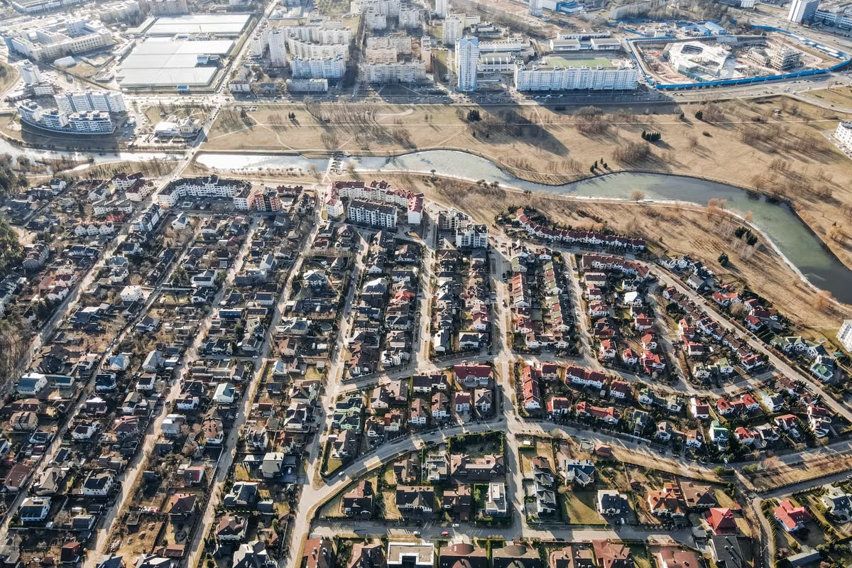
You see a convincing overhead view of a city, but the credit line is missing: is it a satellite photograph, a 3D render, or a Google Earth screenshot?
Fast answer: God's Eye View usually names the viewpoint, not a specific imaging technology or product. Real satellite imagery is captured by sensors and processed; a 3D Earth simulation is rendered from models and spatial data; Google Earth is a viewer that combines multiple kinds of geographic content. Do not call any of them live satellite imagery unless you can verify that claim from a source.
If you are trying to identify what a particular scene represents, check the source notes, capture date, and model or rendering credits before describing it. The appearance alone is not enough.
This guide is for you if you are trying to work out whether God's Eye View means a viewpoint, a technology, or a product. It also helps you distinguish captured satellite imagery from computer-generated Earth views. If you use Google Earth or make content based on it, the sections on data dates and attribution will help you describe what you see more accurately.
God's Eye View describes a viewpoint, not a data source
“God's Eye View” is commonly used for a view from high above, looking down at the ground. The phrase tells you about the perspective. It does not, by itself, tell you what captured or generated the image.
Cambridge Dictionary defines the related expression “bird's-eye view” as a view from a high position, looking down. That helps explain the viewpoint idea, but it does not establish a technical definition for every use of “God's Eye View.” Context still matters. In a film description, it might mean a camera angle. In a map interface, it might mean an overhead display. In a report, it could describe an aerial or satellite view. See the dictionary definition of bird's-eye view for the basic perspective distinction.
When you encounter the phrase, separate four questions:
- Viewpoint: Is the scene viewed from above?
- Data source: Was the surface recorded by a satellite, an aircraft, or another sensor?
- Presentation: Is the surface a photograph, a rendered model, or a composite?
- Tool: Is a particular app or service displaying the content?
One view can answer “yes” to more than one of these. A 3D model can use real aerial imagery as its surface texture. A map viewer can display satellite imagery from different dates alongside terrain or 3D buildings. These are combinations, not mutually exclusive categories.
Satellite imagery records a place; its appearance does not prove when
Real satellite imagery begins with measurements collected by a sensor on a satellite. The data is then processed into products people can view or analyze. Depending on the sensor and product, processing can include correcting geometry, accounting for the atmosphere, or combining bands. So even genuine satellite imagery is not necessarily an untouched camera photograph.
A useful example is Landsat Collection 2 Level-2. USGS describes Level-2 products that include surface reflectance and surface temperature data. These are processed data products, not simply a promise that a picture is a direct, unaltered view of the ground. See the USGS description of Landsat Collection 2 Level-2 products.
Resolution is one reason not to assume that every image shows the same level of detail. Landsat's multispectral bands have a 30-meter pixel size, while its panchromatic band has a 15-meter pixel size; the sensor bands and the product being viewed matter. These figures describe the cited Landsat data, not every satellite image. Check the provider's documentation before comparing imagery or promising a particular level of detail.
Images can also differ in capture date, geographic coverage, cloud conditions, and processing. An image may cover a large region but not show the whole region at once in a viewer. A map may use imagery from more than one collection date. And a processed image may have been adjusted to make features easier to interpret. The USGS overview of high-resolution orthoimagery describes imagery that has been geometrically corrected to align with a map coordinate system. That correction supports accurate placement; it does not mean the image is live or unprocessed in every sense.
This is why realism is a poor test for recency. A crisp image may be old, carefully processed, or assembled from different sources. A hazy or low-detail image may be recent but have different sensor, atmospheric, or display characteristics. Look for a stated acquisition date and provider credit instead.
3D Earth simulations render geometry and data together
A 3D Earth simulation creates a view from spatial data and a rendering process. Inputs may include terrain elevation, building geometry, textures, roads, or other mapped features. The software uses those inputs to draw a scene from a chosen angle.
That does not make the entire scene fictional. A model can be based on measured terrain or building data. Its surface may also use real satellite or aerial imagery as a texture. But the rendered perspective, shadows, and visible geometry are produced by a computer. A textured model is still a model, even when its texture comes from a real photograph.
Google's product information on 3D buildings in Google Earth explains that the service includes 3D building content. Google's photorealistic 3D tiles documentation describes 3D content designed for rendering and display. These examples show why “real data” and “computer-generated image” are not opposites: real-world data can be inputs to a rendered scene.
When you need to tell a model from a flat image, inspect the scene and its credits. Look for building sides, visible roofs at an oblique angle, consistent terrain depth, and labels that mention 3D models or rendered content. These clues can indicate 3D presentation, but they do not prove which source data was used. Check the accompanying data notes if you need to make a factual claim.
| What you are checking | Real satellite imagery | 3D Earth simulation |
|---|---|---|
| Main content | Sensor measurements processed into an image or data product | A rendered view built from spatial data and models |
| Useful source evidence | Provider, sensor or product name, acquisition date, processing notes | Model or rendering credits, terrain or building data notes |
| What it can include | Corrected, combined, or otherwise processed imagery | Real imagery used as a texture, plus modeled geometry |
| What appearance alone cannot prove | That the image is live, raw, or from one capture date | That all geometry or textures are fictional |
Google Earth is a viewer that can show several kinds of content
Google Earth describes how its imagery is collected and explains that imagery dates can vary by location. That matters when you are checking a particular place: do not assume one date applies to the entire globe or to every layer. Use the Google Earth explanation of image collection and dates to understand the difference between viewing imagery and verifying when it was captured.
The product is best understood as a geographic viewer, not as one satellite, one image archive, or one continuous live feed. What appears on screen may include satellite or aerial imagery, terrain, 3D buildings, and other geographic content. The mix and date depend on the area and the content shown. Consult the imagery date and attribution displayed for the specific location rather than generalizing from a different place.
The table below helps you choose the most accurate description. It also shows why God's Eye View, satellite imagery, a 3D simulation, and Google Earth should not be treated as four competing image types.
| Term | What it identifies | What to verify before describing a scene |
|---|---|---|
| God's Eye View | An overhead viewpoint or visual expression | Whether the context means a camera angle, map view, or something else |
| Satellite imagery | Imagery or data collected by a satellite sensor and processed | Provider, product, capture date, coverage, and processing notes |
| 3D Earth simulation | A rendered view built from spatial data and models | Model or rendering notes, geometry sources, and any imagery textures |
| Google Earth | A viewer for geographic content | The displayed source credits, imagery date, and whether 3D content is present |
If you are analyzing satellite datasets rather than just viewing a map, NASA's LAADS DAAC tools and services provide access to data tools and services. That is a different task from simply recognizing an overhead view: a dataset workflow calls for source and product documentation, not just a screenshot.
Use source notes before making a claim about a scene
A creator, student, or analyst often needs a short but accurate caption. Use the following sequence before you publish or cite an overhead view.
- Find the original source. Trace the image to its source page, data provider, report, or application. If you only have a reposted screenshot, say that the original source is unverified.
- Read the credit line. Note the provider and any named imagery or data product. A map service credit is useful, but it may not identify the date or sensor for the specific view.
- Look for an acquisition date. Record the stated capture date or date range if one is provided. Do not infer it from the scene's appearance or from the date you viewed the image.
- Check for processing details. Look for terms such as orthorectified, surface reflectance, composite, mosaic, or processed. These labels can explain why a true sensor product may not look like an unedited photograph.
- Check whether geometry is rendered. Building sides, terrain relief, or an oblique camera angle can be signs of 3D content. Search the source notes for model, mesh, terrain, or rendering details.
- Separate the viewer from the data. If the content appears in Google Earth, name Google Earth as the viewer. Use the displayed attribution and date to identify the content itself.
- Write only what the evidence supports. If you cannot confirm the capture date or source, describe the image as an overhead view or a screenshot from the named tool. Do not call it “live” or “real-time.”
If you plan to inspect source files on a Mac, first check whether the GIS or visualization tool you plan to use supports your file formats and workflow. For general service-use details, consult the Hashvps help center. If you also need background about the provider, see Hashvps's company information. Neither service information nor a viewer screenshot proves the origin or freshness of an image; only the relevant data attribution and documentation can do that.
Common misreadings and their limits
The most common mistake is treating a viewpoint as evidence about a sensor. “God's Eye View” does not prove that a satellite took the image. It only suggests an overhead perspective unless the surrounding description defines it more narrowly.
The second mistake is treating Google Earth as one satellite image source. It is a viewer. Its content can combine imagery and 3D information, and the dates can differ across locations. A screenshot of a place is not enough to establish when the underlying imagery was collected.
A third mistake is assuming that a 3D Earth simulation must be invented. Models may use measured terrain, building information, or captured imagery. The rendered output is computer-generated, but its inputs can represent real places. State which part is modeled and which part is based on imagery when the source information allows you to do so.
Use this quick checklist before you caption or cite an overhead scene:
- [ ] Have you identified the viewpoint separately from the data source?
- [ ] Is there a provider or product credit?
- [ ] Is an acquisition date shown for this specific area?
- [ ] Does the source describe processing, a model, or a rendering?
- [ ] Have you avoided calling the scene live without direct evidence?
FAQ: Check the source before naming the view
Is God's Eye View a real satellite photograph?
Not necessarily. It is usually a description of an overhead perspective, so it can refer to a satellite image, an aerial photo, a rendered scene, or a composite. Confirm the source and capture date before calling it a photograph. If you cannot verify those details, describe the visible perspective without claiming how or when the image was made.
What is the difference between God's Eye View and a 3D Earth simulation?
God's Eye View describes where the viewer appears to be looking from: above the surface. A 3D Earth simulation describes how a scene is generated and displayed, using spatial data and models. A simulation can use real imagery for its surface, so the perspective and production method can overlap. Check rendering notes and source credits to identify both.
Does Google Earth show a God's Eye View or real-time satellite imagery?
Google Earth can present an overhead perspective, but that does not mean its imagery is live. It is a viewer that can show imagery and other geographic content, with dates that vary by location and source. Check the date and attribution for the area on screen. Without direct evidence of live collection, call it a Google Earth view or imagery, not real-time satellite imagery.
Can a God's Eye View scene be both real and computer-generated?
Yes. A rendered 3D scene may use real terrain data, measured building geometry, or captured imagery as a texture. The final viewpoint is rendered, even when some of its inputs come from real-world measurements. For a careful description, identify the source data and the rendering method separately rather than labeling the whole scene simply “real” or “fake.”
When you assess an overhead view, the decisive evidence is its source information—not how convincing it looks. For a one-off check, you may not need anything beyond the original attribution and date. If you need to inspect large geospatial files repeatedly, a local Mac setup may suit you better when you need persistent storage or direct hardware access; a temporary rented Mac from Hashvps may be more convenient when you need a separate environment without setting up another machine. Choose based on the work you actually need to do, then return to the image credits and data notes to describe the scene accurately.
Verify What You’re Seeing
Check the source, capture date, and image metadata before describing an overhead view as satellite imagery.
Compare the viewing angle and level of detail to tell a straight-down image from an oblique 3D rendering.